Archbald Pothole State Park is a 150 acre park in the middle of a busy area in Archbald, Lackawanna County, Central Pennsylvania. The park consists of the pothole, a short trail, and some interpretive signs. Another park is located on the property, and it has athletic fields.
Park Activities:
 Yes, there is hiking.
  Yes, there is hunting.
  There is no information on geocaching available.
  No, there is no ATVing.
  No, there is no bacci ball.
  No, there is no backpacking.
  No, there is no baseball or softball.
  No, there is no basketball.
  No, there is no biking.
  No, there is no boating.
  No, there is no camping.
  No, there is no canoeing or kayaking.
  No, there is no collecting.
  No, there is no disc golf.
  No, there are no DRONEs allowed.
  No, there is no fishing.
  No, there is no football.
  No, there is no gold panning.
  No, there is no golfing.
  No, there is no group camping.
  No, there are no guided tours.
  No, there is no hang gliding.
  No, there is no horseback riding.
  No, there is no horseshoes.
  No, there is no ice boating.
  No, there is no ice fishing.
  No, there is no ice skating.
  No, there is no jet skiing.
  No, there are no junior ranger programs.
  No, there is no kite surfing.
  No, there is no mini golf.
  No, there is no pickleball.
  No, there is no picnicking.
  No, there is no power boating.
  No, there are no ranger programs.
  No, there is no rock climbing.
  No, there is no row boating.
  No, there is no sailboarding.
  No, there is no sailing.
  No, there is no SCUBA diving.
  No, there is no shuffleboard.
  No, there is no skateboarding.
  No, there is no cross country skiing.
  No, there is no downhill skiing.
  No, there is no sledding.
  No, there is no snorkeling.
  No, there is no snow mobiling.
  No, there is no snow tubing.
  No, there is no snowshoeing.
  No, there is no soccer.
  No, there is no stand up paddleboarding.
  No, there is no surfing.
  No, there is no swimming.
  No, there is no tennis.
  No, there is no trap shooting.
  No, there is no volleyball.
  No, there is no water skiing.
  No, there is no whitewater rafting.
  No, there is no wind surfing.
  No, there is no zipline.
Park Amenities:
 Yes, there is a parking lot.
  There is no information about benches available.
  There is no available information about a bike rack.
  There is no available information on green space.
  There is no information on handicap accessibility.
  There is no information available about trash cans.
  No, there is no amphitheater.
  No, there is no archery range.
  No, there is no auditorium.
  No, there are no batting cages.
  No, there are no beach showers.
  No, there are no bleachers.
  No, there is no boardwalk.
  No, there is no boat ramp.
  No, there are no cabins or cottages.
  No, there is no camp store.
  No, there are no classrooms.
  No, there is no dog park.
  No, there is no driving range.
  No, there is no dump station.
  No, there are no electricity hookups.
  No, there is no food concession.
  No, there is no gazebo.
  No, there is no gift shop.
  No, there are no grills.
  No, there is no inn or lodge.
  No, there is no laundry.
  No, there is no marina.
  No, there are no meeting facilities.
  No, there is no observation deck or tower.
  No, there is no observatory.
  No, there is no park office.
  No, there is no pavilion.
  No, there are no picnic tables.
  No, there is no pier.
  No, there is no playground.
  No, there are no recreational buildings.
  No, there are no recycling cans.
  No, there is no restaurant.
  No, there are no sewer hookups.
  No, there is no shooting range.
  No, there are no showers.
  No, there is no skate park.
  No, there is no splash pad.
  No, there is no swimming pool.
  No, there are no toilets.
 No, there are no flush toilets.
No, there are no vault (pit) toilets.
No, there is no port-a-potty.
 No, there are no vending machines.
  No, there is no visitor center, museum, or environmental education center.
  No, there is no water fountain or pump.
  No, there are no water hookups.
  No, there are no wellness stations.
  No, there is no WiFi.
  No, there are no yurts.
Park Features:
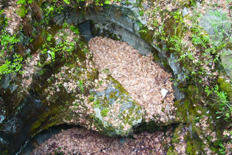
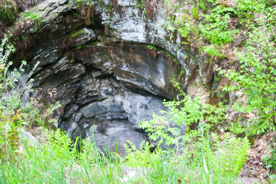
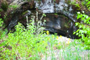
 Yes, there are geologic features.
 A pothole is often formed at the base of a waterfall, but in this case it was formed with glacial melt water.
 Yes, there is a stream or river.
  No, there is no bog.
  No, there is no canal.
  No, there is no canyon.
  No, there is no cave.
  No, there is no coral reef.
  No, there is not a covered bridge.
  No, there is no cultural significance.
  No, there is no dam.
  No, there is no desert.
  No, there is no forest.
  No, there is no fort.
  No, there is no fountain.
  No, there is no furnace.
  No, there is no historical monument.
  No, there is no historical significance.
  No, there is no lake.
  No, there is no lake beach.
  No, there is no lighthouse.
  No, there is no mill.
  No, there are no mountains.
  No, there is no pond.
  No, there is no prairie.
  No, there are no sand dunes.
  No, there is no shore beach.
  No, there is no veterans memorial.
  No, there is no volcano.
  No, there are no waterfalls.
  No, there are no wetlands.
  No, there is no windmill.
 History
The pothole formed close to 15,000 years ago during the Wisconsin Glacial Period. It was discovered by a coal miner in 1884. It was filled with small rocks which were dug out, and for a brief time it was used to vent a mine shaft.
Archbald Pothole was a tourist and geologist destination for a while before it was left to the Lackawanna Historical Society. In 1940 the pothole and surrounding land became a county park. It was given to the state in 1961, and opened as a state park in 1964.
Geology
Archbald Pothole was formed during the Wisconsin Glacial Period roughly 15,000 years ago. The pothole was formed by the swirling action of glacial melt water, spinning small rocks and sand around and carving out a hole through layers of sandstone, shale, and coal.
Another pothole is believed to be nearby, but it was not unburied due to cost.
Watershed Address: South Branch Tunkhannock Creek - Tunkhannock Creek - North Branch of the Susquehanna River - Susquehanna River - Chesapeake Bay - Atlantic Ocean
Pictures
Archbald Pothole State Park Pictures